Dedicated Observations
Geophysical Observations
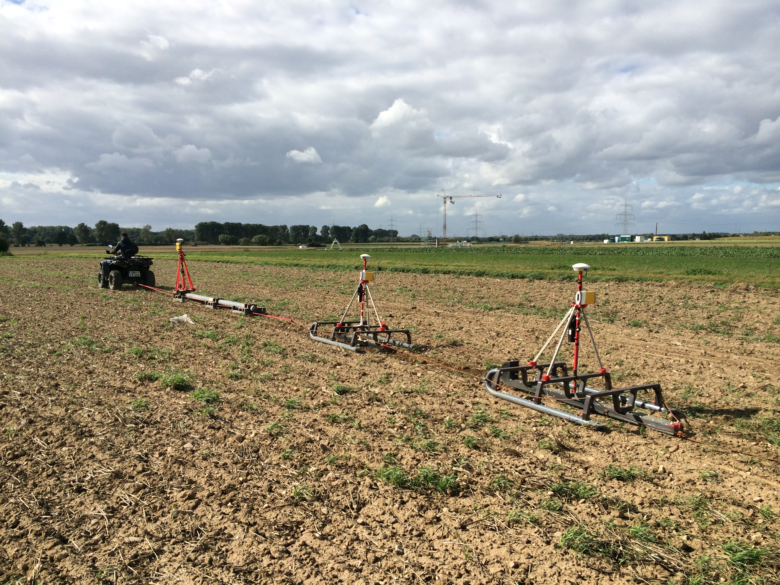 EMI sleds at the Selhausen test site (Photo: Christian von Hebel FZJ-IBG3)Ground-penetrating radar and electromagnetic induction (EMI) measurements can be used to noninvasively investigate the structure, composition, and hydraulic state of the subsurface. At the Selhausen test site, large-scale investigations of agricultural fields in an area of 1 by 1 km were performed by using multi-coil EMI instruments. These were inserted into custom-made sleds (see picture) that were equipped with global positioning systems and pulled by an all-terrain vehicle. The multi-coil EMI instruments provide apparent electrical conductivity values for multiple depth ranges of investigation. These data can be used to numerically obtain subsurface structures that indicate hydrologically active layers. Contact:
Lysimeter Stations
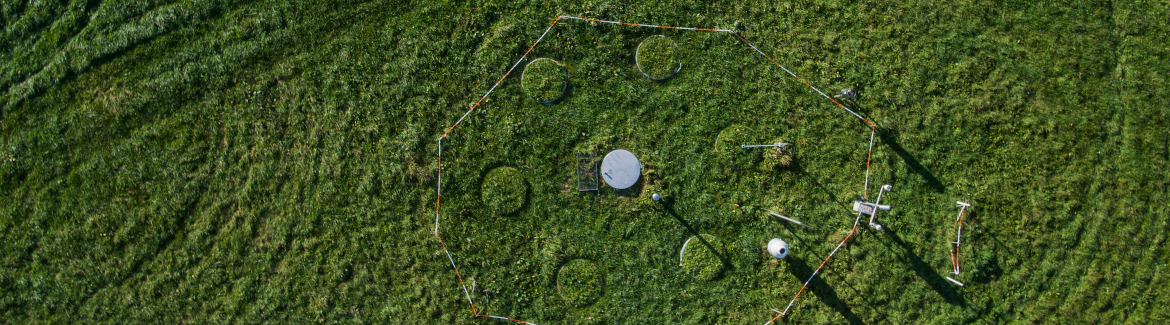
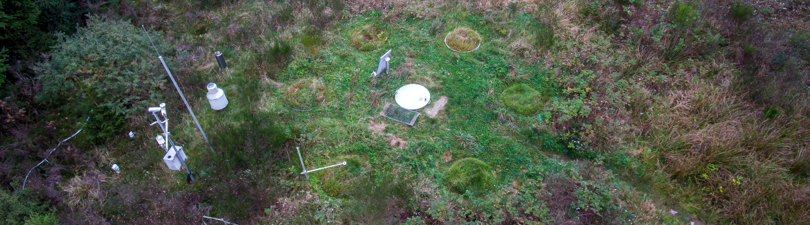
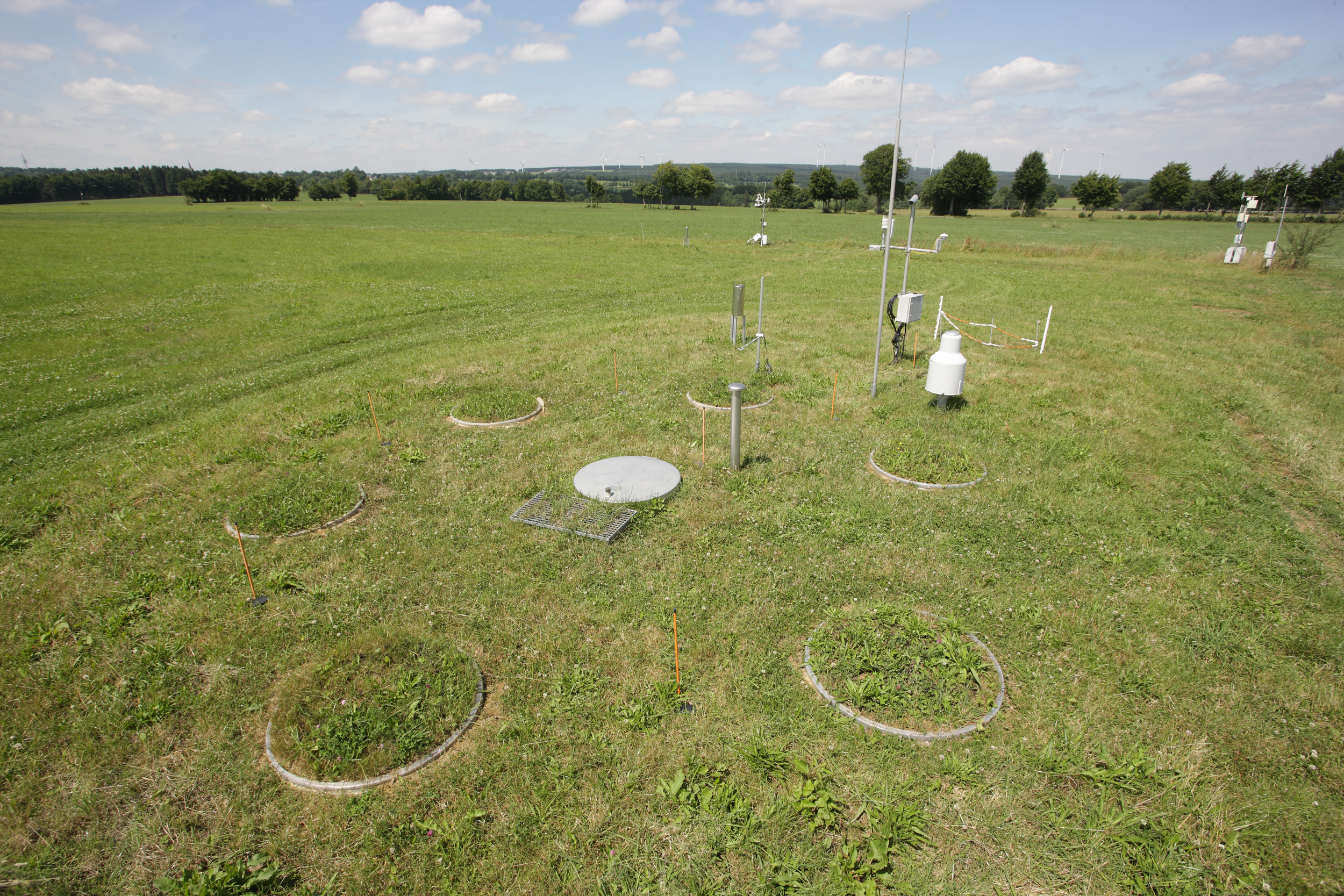 Lysimeter station at the Rollesbroich test site (Photo: FZJ). A network of six lysimeter stations has been installed in the Rur catchment (four at Selhausen, one at Rollesbroich, and one at Wüstebach) to determine carbon and nitrogen fluxes, as well as precipitation, actual evapotranspiration (resolution of 0.01 mm), change in soil water storage, leachate, and upward directed water flow from capillary rise. Each lysimeter station features six lysimeters that are arranged in a hexagonal design around the centrally placed service unit hosting analytical and data recording devices. The lysimeters are made of stainless steel, with a surface area of 1.0 m2 and a length of 1.5 m. All lysimeters were filled with monolithic soil cores. Vegetation on the lysimeters is natural grassland with and without management or cereal crop rotation. The lower boundary condition of each lysimeter is controlled using parallel suction racks that were installed after the lysimeter was filled. The basic idea of the SOILCan lysimeter network is based on the “Space for Time” concept. To induce the effect of the predicted climate change in Germany on forest meadow, grassland and arable soils, lysimeters were translocated from their original sites along a temperature and precipitation gradient within and across TERENO observatories. Contact:
Remote Sensing
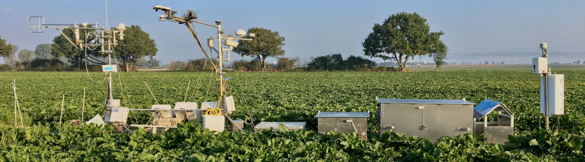
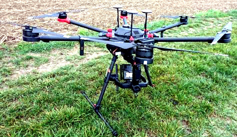 Drone with multispectral remote sensors (Photo: FZJ). Multispectral remote sensing data have been used in water balance and N transport simulations in the Rur catchment. A new aspect is the implementation of multispectral, thermal and LIDAR data from drones (Unmanned Aerial Systems, UAS). TERENO sites are also used as test beds for future satellite missions, such as Tandem-L and ROSE-L. Those radar satellites are able to deliver data for soil moisture and vegetation structure. Airborne campaigns show the capabilities of these new sensors and provide initial data for algorithm development. Contact: