


Derivation of soil parameters from hyperspectral remote sensing data
PhD thesis
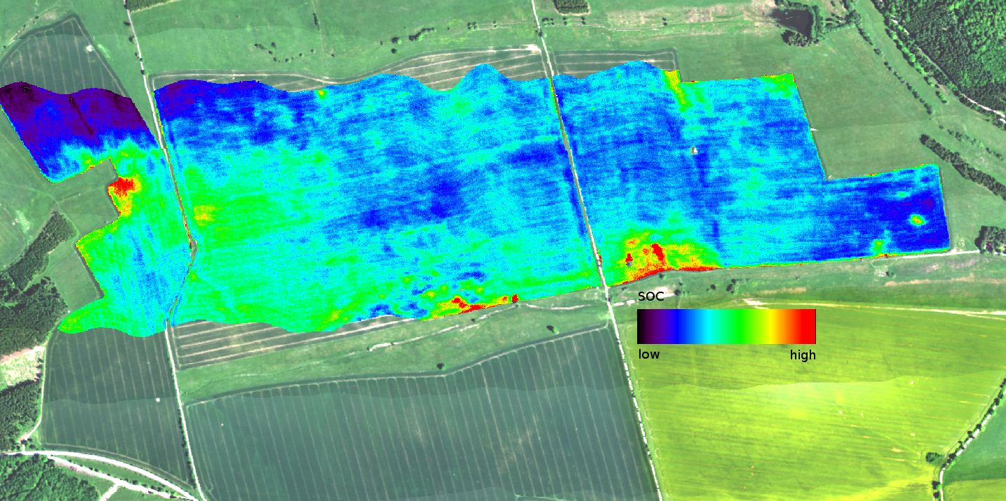
In environmental sciences, hyperspectral remote sensing has demonstrated its great potential for retrieving information in a wide range of topics, e.g. vegetation analysis and species distinction. In this work, hyperspectral remote sensing data are used to retrieve information on soil parameters. The data is recorded by an airborne sensor over bare soil areas. Each pixel in this so called “data cube” consists of a full reflectance spectrum from about 400 nm to 2500 nm – this is usually referred as hyperspectral remote sensing or imaging spectrometry. This recorded spectral reflectance signal (if recorded over bare soil) is known to be related to the soil parameters, in this case soil texture (clay, silt, sand fraction) and soil organic carbon (SOC).
For extracting these soil parameters from the reflectance data cube, machine learning algorithms are used. These methods allow the extraction of the specific relationship between the input data (in this case the reflectance data) and target data (in this case the soil parameters). The algorithms are trained with a sample data set, consisting of the input data (the spectral information) and the corresponding known target data (soil parameter).
To obtain the target soil parameters for the training data set, a sampling campaign and a subsequent lab analysis of these samples are done. Using the results of athe lab analysis it is possible to train the machine learning model and to finally predict the soil parameters for the whole bare soil area inside the remote sensing image.
The resulting spatial distribution of these parameters may e.g. help modelers by providing more accurate input data about soil properties and thus supports creating better models.