Instrumentation
Micrometeorological Instrumentation
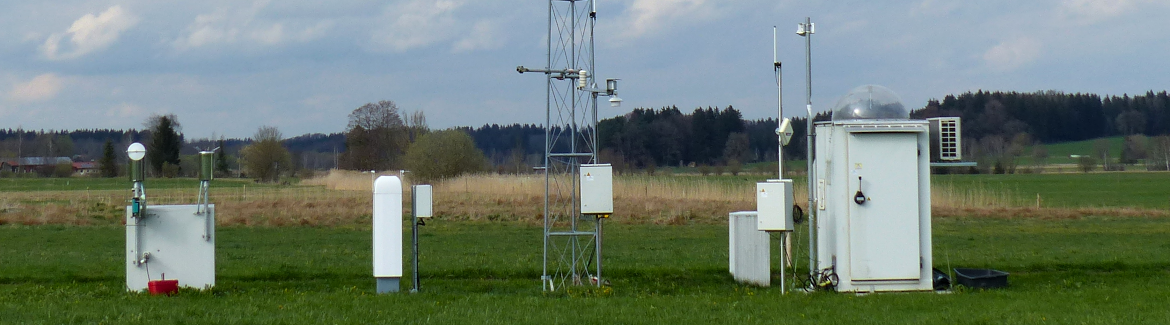
 EC Station Fendt (Foto: Alexander Krämer WWL)
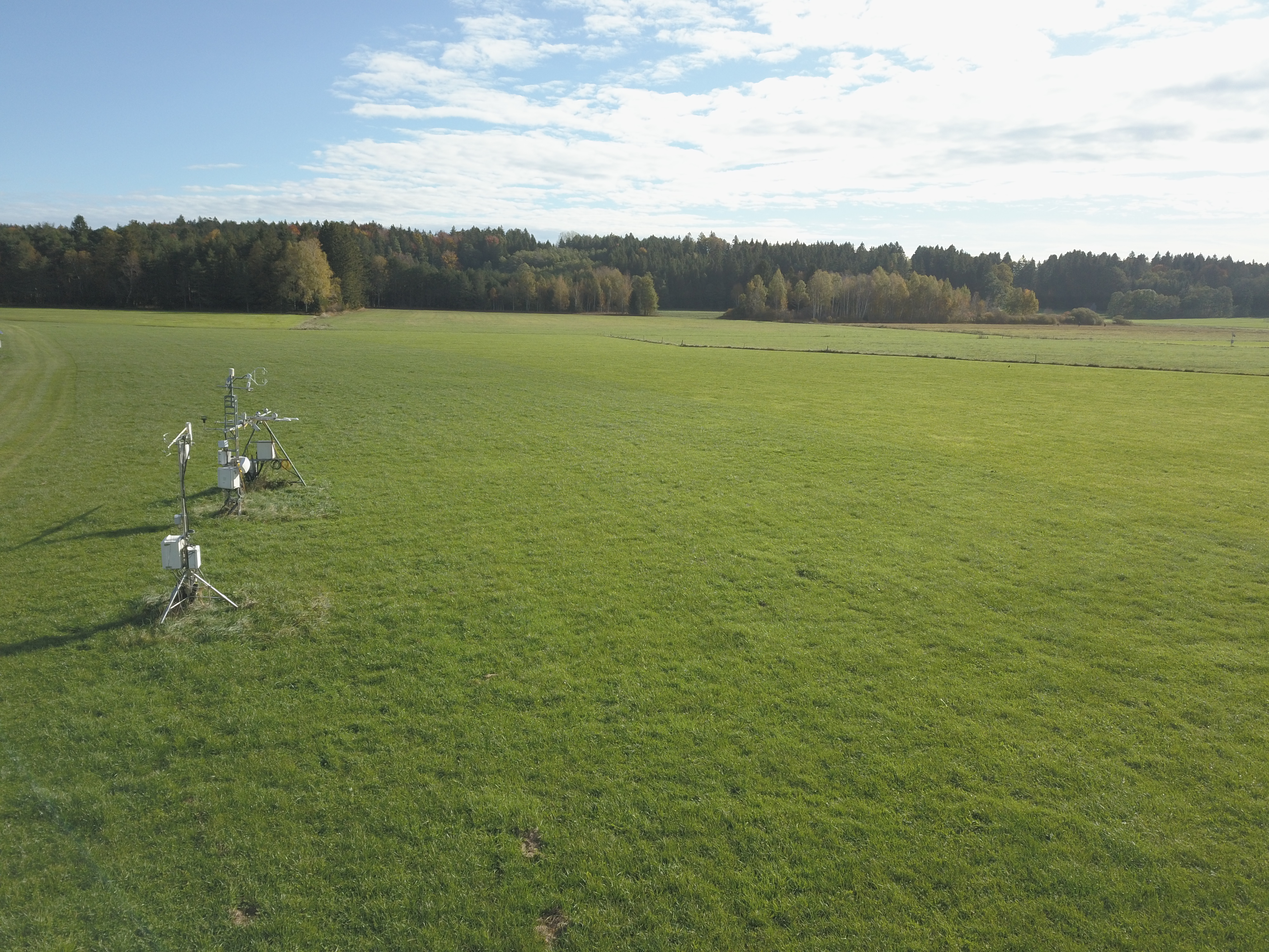
Eddy-covariance measurements are conducted at the three main grassland sites Graswnag (DE-Gwg), Rottenbuch (DE-RbW) and Fendt (DE-Fen) as well as at a wetland site Schechenfilz (DE-SfN) and forest site Lackenberg (DE-Lkb). In addition to the EC measurement setup (CSAT-3, Campbell Scientific; LI-7500 LI-COR Biosciences), the grassland sites are equipped to observe the full energy balance, including a four-component net radiometer (CNR 4, Kipp & Zonen), self-calibrating soil heat flux plates (HFP01-SC, Hukseflux), soil temperature and soil moisture sensors (T107 and CS616, Campbell Scientific), and basic meteorological instrumentation for measuring mean wind speed and direction, air temperature, relative humidity, air pressure, and precipitation (HMP45 and WXT520, Vaisala). A ceilometer (CL51, Vaisala) is deployed at each of the three sites to determine the height of the atmospheric boundary layer. The TERENO sites DE-Fen (C1), DE-Gwg (C3), DE SfN (C3) are part of ICOS, a pan-European research infrastructure that provides harmonized and high-precision scientific data on C cycling and GHG budget and perturbations.
Contact:
Lysimeter Network
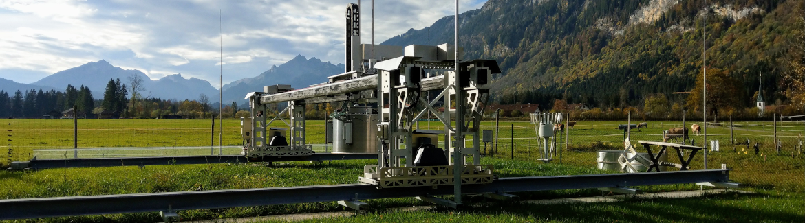
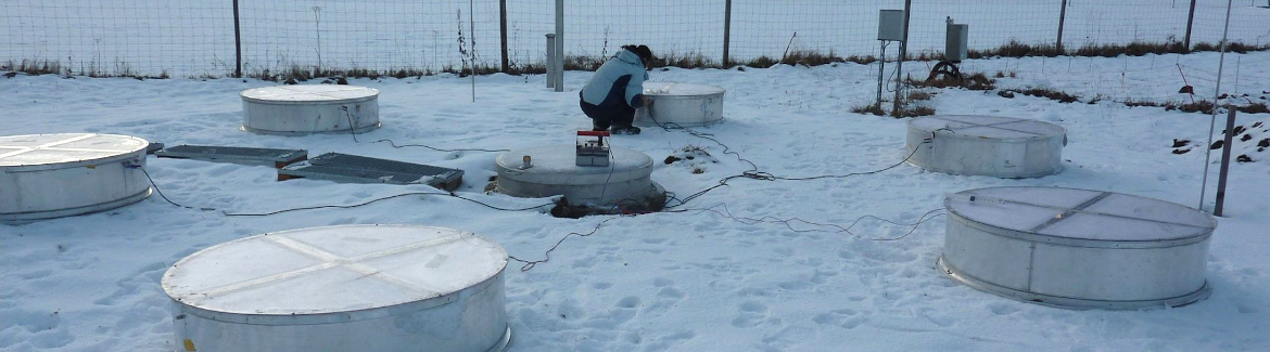
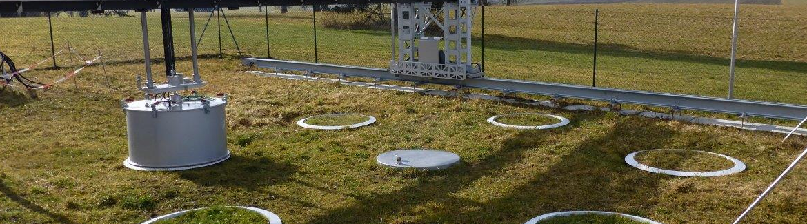
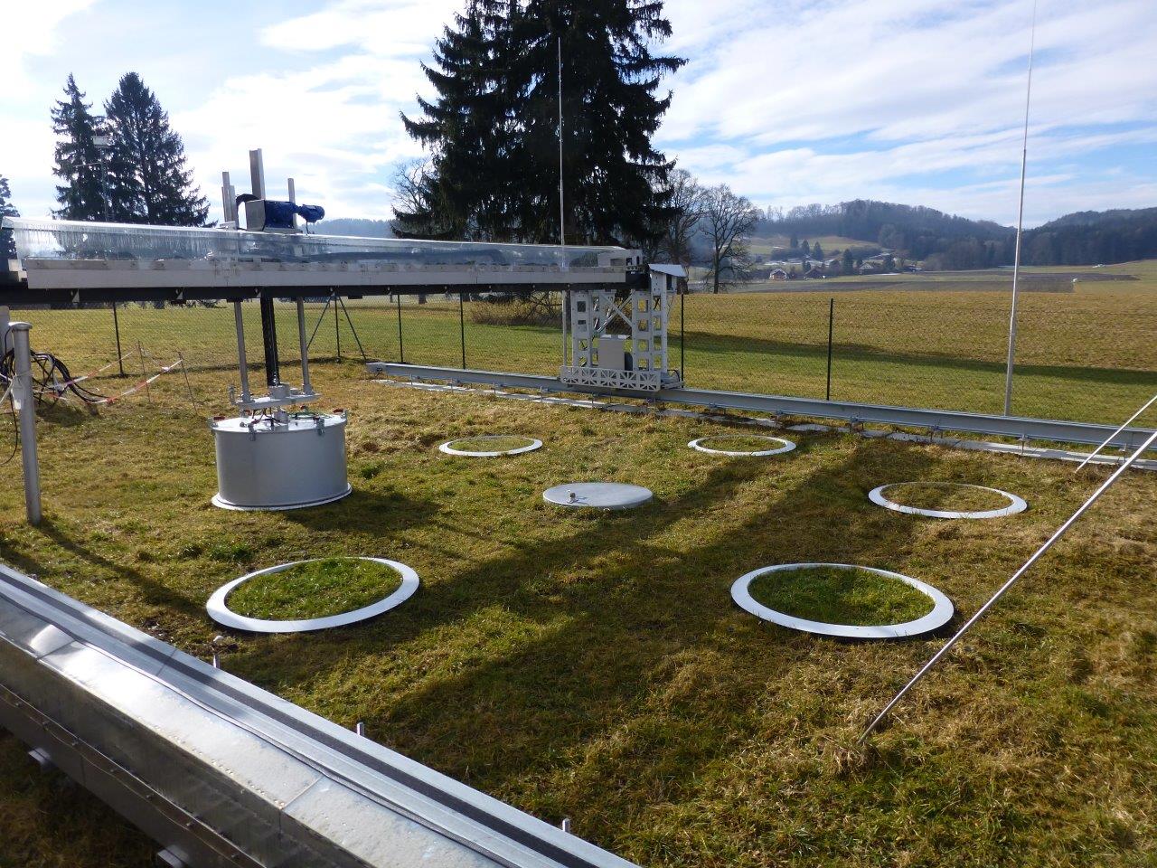 Lysimeter GHG Measuring System Fendt (Foto: Rainer Gasche KIT/IMK-IFU)Lysimeter are installed at the three main grassland sites DE-Gwg, DE-RbW, and DE-Fen. The underlying idea is based on the “space for time” concept which anticipates climatic change over time by a translocation of intact soil–plant mesocosms in space. The main research focus of the lysimeter study in the TERENO Pre-Alpine Observatory is of the impact of climate and management changes on the components of grassland water, C and N cycling and budgets, biosphere–atmosphere–hydrosphere matter exchange (i.e., GHG emissions and leaching), as well as yields and biodiversity. To that end, a total of 36 intact grassland soil cores (area, 1 m2; depth, 1.4 m) were excavated and transferred to lysimeters at DE-Gwg (n = 18), DE-RbW (n = 12), and DE-Fen (n = 6). Six DE-Gwg lysimeters each were transferred to DE-RbW and DE-Fen, and the remaining six were left in DE-Gwg as control . Accordingly, six lysimeters each from DE-RbW were transferred to DE-Fen or remained at DE-RbW. This led to operation of 18 lysimeters at DE-Fen, 12 at DE-RbW, and six at DE-Gwg. Six lysimeters were arranged in a hexagonal structure around one service unit. At each lysimeter station, half of the lysimeters were subject to intensive management and the other half to extensive management following local farmers’ practices.
For each single lysimeter, rates of water balance components (i.e., precipitation, actual evapotranspiration, and seepage water are derived from precision weighing of lysimeters and water tanks. In all lysimeters, volumetric water content and soil temperature are measured at depths of 10, 30, 50, and 140 cm. Soil water is regularly collected by suction cups at the same depths and analyzed for NH4, NO3, dissolved organic N, and dissolved organic C. Soil GHG exchange of CO2, N2O, and CH4 is measured by the static chamber approach at DE-Fen, DE-RbW and DE-Gwg by robotic systems that move on rails sequentially from lysimeter to lysimeter and lower a rubber-sealed static dark chamber on top of a collar at each location.
Soil Moisture Network
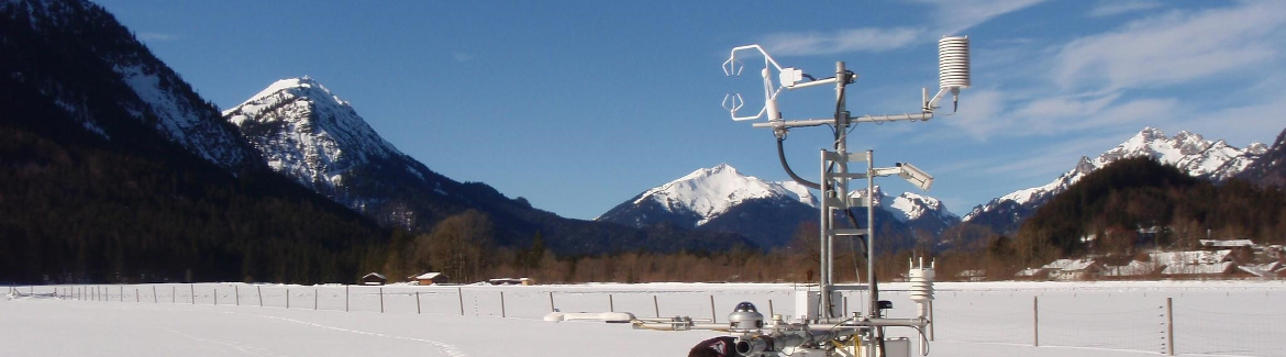
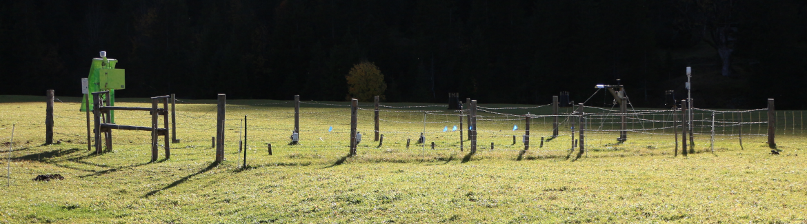
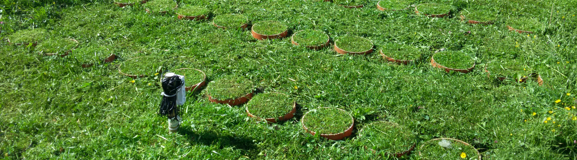
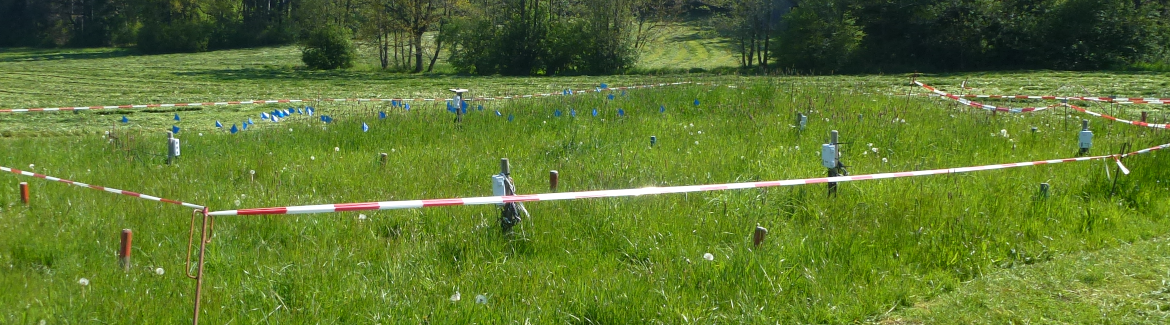
Since June 2015, spatially distributed measurements of soil moisture, temperature, and matrix potential have been performed at DE-Fen with the wireless underground sensor network SoilNet with 55 measurement profiles distributed over a total area of about 300 by 300 m, with 20 profiles being distributed along a regular 70x70-m grid and 35 profiles being randomly scattered to provide adequate spatial coverage and to facilitate geostatistical analysis of the data. Measurements are performed at depths of 5, 20, and 50 cm in a temporal resolution of 15 min. In addition to soil water potential (MPS-6, Decagon Devices) and water content (SMT100, Truebner GmbH), both sensors record soil temperature.
Contact:
Cosmic-Ray Neutron Sensors
From the neutron sensor measurements, soil moisture and snow water variations can be observed within a multihectar footprint size. In TERENO Pre-Alpine, a network of four stationary sensors is operated at DE-Fen, Ach, DE-Gwg, and Esterberg. The site elevations follow a gradient from 600 to 1270 m asl. Each site is equipped with a bare and a moderated CRS-2000B sensor (Hydroinnova Inc.) and an additional measurement device for air pressure (onboard the datalogger), temperature, and humidity (CS215, Campbell). The recording interval for all variables is 10 min and data are transferred by cellular telemetry. The DE-Fen device is situated in the center of soil moisture network.
Contact:
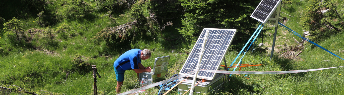
Rainfall Observation Using Commercial Microwave Link Networks
Due to the high spatiotemporal variability of precipitation, its accurate estimation is challenging. In particular, in mountainous terrain, rain gauges and weather radars are limited in providing reliable observations. A promising new technique that helps improve rainfall estimation is the use of attenuation data from commercial microwave link (CML) networks, which are used to provide a large part of the backhaul of the cell phone network.To accompany the research on spatially distributed rainfall estimation via CMLs, we have developed a dedicated microwave transmission device to study the relationship between precipitation and microwave propagation in more detail. The system operates two frequencies (22.235 and 34.8 GHz) and two polarizations in parallel, providing the option to analyze differential measurements, which provide more insight into the precipitation drop size distribution and error sources like antenna wetting. Together with two disdrometers, the system is installed at the DE-Fen site.
Contact:
Remote Sensing by X-Band Radar
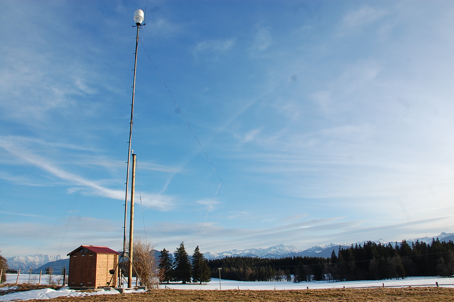 X-Band Radar Geigersau (Foto: KIT/IMK-IFU)Since June 2009, a single polarization X-band rainfall radar (Selex ES GmbH) is operated a 16-m mast at the Geigersau site (955 m asl). Its 90-cm antenna detects the backscatter signals of precipitation at 3° elevation in high temporal and spatial resolution of 12 scans min−1 and 2° by 100-m azimuthal sectors, respectively. Corrected X-band radar rainfall data, with its high spatial-temporal resolution, can improve the skill of hydrological modeling for the Ammer catchment with respect tothe lower resolution RADOLAN data.
Contact: